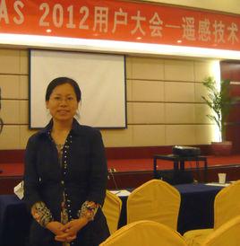
個人簡介
2001年1月16日至2002年1月20日到美國東密西根大學留學訪問1年;2005年5月10日至7月17日到日本東京遙感技術中心研修“衛星遙感技術”。2005年11月在中科院遙感所給11名非洲班學員講授課程;2006年12月至2007年3月,負責3名亞太碩士班學員在中科院遙感所的遙感實習任務;曾兼職《遙感學報》英文編輯。現任河北師範大學資源與環境科學學院副教授,地理信息系統專業碩士生導師,中國地理學會會員。為本科生和研究生主講課程《城市地理信息系統》、《遙感導論》和 《遙感圖像處理原理》。
主要研究領域
高光譜遙感、遙感影像數字處理與分析、全球變化遙感。
主持的主要課題
1. 河北師範大學博士基金“植被生化組分遙感定量反演模型研究”,2009-2010。
2. 國家自然科學基金“基於地價水平時空變化的城市合理用地規模研究”(40871053),2008-2010,第四參加人
3. 國家自然科學基金:冀北地區土地利用/覆蓋變化的生態閾值研究,2002-2004(第三完成人)
4. 河北師範大學科學研究基金項目:遙感與GIS 支持下土地利用/覆蓋多源信息融合研究,2003-2005。
5. 河北師範大學第五批重點建設課程:遙感導論,2005-2007。
6. 河北師範大學第六批教改課題:遙感技術教學改革實踐和課程體系建設,2005-2007(第二主研)。
7. 河北師範大學第七批重點建設課程:遙感圖像處理,2007-2009。
8. 河北師範大學第八批教改課題:加強GIS專業遙感技術的實驗實踐,探索人才培養新模式,2007-2009。
攻讀博士學位期間,參加了多項科研課題,如國家自然科學基金:基於寬光譜遙感數據的細分光譜遙感圖像模擬研究;中國科學院知識創新工程項目:定量遙感套用的幾個關鍵問題研究;973項目:基於多模式、多時空遙感信息融合的理論與方法;歐盟合作研究項目CEOP-AEGIS等。
代表性科研成果
(一) 論文
在國家核心期刊以上刊物發表論文20餘篇,其中EI檢索7篇,ISTP檢索3篇。代表性論文有:
1. Yuan Jinguo, Niu Zheng,Evaluation of atmospheric correction using FLAASH,2008 International Workshop on Earth Observation and Remote Sensing Applications, EORSA, p4620341。 EI 檢索
2. Xu Jingjing, Yuan Jinguo, Liu bo, Wang Changyao,Inversion of preeipitable water vapor in Hongkong, 2008 International Workshop on Earth Observation and Remote Sensing Applications, EORSA, p 4620338。 EI 檢索
3. 袁金國,牛錚. 基於Hyperion高光譜圖像的氮和葉綠素製圖,農業工程學報,2007,23(4):172-178。 EI 檢索
4. Jinguo Yuan, Zheng Niu. Classification Using EO-1 Hyperion Hyperspectral and ETM Data. FSKD, pp. 538-542, Fourth International Conference on Fuzzy Systems and Knowledge Discovery (FSKD 2007), Vol.3, 2007。 EI 檢索
5. Jinguo Yuan, Zheng Niu, etc. Model simulation for sensitivity of hyperspectral indices to LAI, leaf chlorophyll and internal structure parameter. Proceedings of SPIE,Geoinformatics 2007: Remotely Sensed Data and Information. Volume 6752, 675213。 EI 、 ISTP 檢索
6. Jinguo Yuan, Zheng Niu. Nitrogen content estimation using Hyperion hyperspectral image based on normalized band depth method. Proceedings of SPIE,MIPRI Multispectral Image Processing and Pattern Recognition, Volume 6787,2007。 EI 檢索
7. Jinguo Yuan, Zheng Niu. Land degradation monitoring using Time-series MODIS and Landsat TM Data. The Second International Conference on Space Information Technology. Volume 6795, 2007。 EI 、 ISTP 檢索
8. Wenpeng Lin, Jinguo Yuan, etc. Extracting crop area planted based on genetic algorithm with neural network using MODIS data,Proceedings of SPIE, Geoinformatics 2006: Remotely Sensed Data and Information. Vol. 6419, p 64190J。 EI 檢索
9. Li Wang, Zheng Niu, Jun Yin and Jinguo Yuan. Aplication of IKONOS image and BP model to evaluate potential of urban land intensive use,Proceedings of SPIE, Geoinformatics 2006: Remotely Sensed Data and Information, 2006, Volume 6419,2006。 EI 檢索
10. YUAN Jinguo, Wang Wei. Land use/cover information extraction using remote sensing and GIS, The Proceedings of The China Association for Science and Technology. Vol.1. No.1. Science Press,2004。 ISTP 檢索
11. Jinguo Yuan, Zheng Niu. Evaluation of atmospheric correction using FLAASH, Earth Observation and Remote Sensing Applications, 2008. International Workshop on Publication Date: June 30 2008-July 2 2008. Proceedings of IEEE.
12. YUAN Jinguo, NIU Zheng, WANG Chenli. Vegetation NPP Distribution Based on MODIS Data and CASA Model—A Case Study of Northern Hebei Province. Chinese Journal of Geographical Science,2006,16(4):334–341。
13. 袁金國,王衛,龍麗民. 河北壩上生態脆弱區的土地退化及生態重建.乾旱區資源與環境,2006,20(2):139-143。
14. Yuan Jinguo, Liu Jinsong, WangWei & Niu Zheng. Land Degradation Evaluation in North Hebei Province Based on Remote Sensing and GIS. Chinese Journal of Population, Resources and Environment,2006,4(3):28-36。
15. YUAN Jinguo, NIU Zheng. Vegetation CO2 Flux Modeling Using Remote Sensing. Proceedings of the Third International Symposium on Future Intelligent Earth Observation Satellites. May 2007:403-406. Science Press.
16. 袁金國,王衛,多源遙感數據融合套用研究,地球信息科學,2005. Vol.7,No.3。
17. 袁金國,王衛,京津風沙源治理區森林動態遙感監測研究,安徽農業科學,2005,33(3)。
18. 袁金國,魏立濤等,遙感監測乾旱圖像產品自動生成系統的設計,安徽農業科學,2005,33(4)。
19. 袁金國,牛錚. TRMM衛星和全球降雨觀測計畫GPM及其套用,安徽農業科學,2006,34(9)。
20. Jinguo Yuan. Identification of Forest Vegetation Using Vegetation Indices,Chinese Journal of Population, Resources and Environment,2004,2(4)。
(二)著作
主編:高等學校教材《遙感圖像數字處理》,中國環境科學出版社,2006年。
翻譯:《攝影測量與遙感在中國Photogrammetry and Remote Sensing in China》第二章、第五章,測繪出版社,2008年,ISBN 978-7-5030-1863-3。

