內容簡介
 自然介質電磁散射與輻射傳輸信息
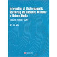
《自然介質電磁散射與輻射傳輸信息(英文版)》作為“自然介質電磁散射與輻射傳輸信息”的第二卷,選自我2001—2010年期間在國際學術刊物上發表的部分學術論文。其第一卷包括1983—2000年間的工作已由科學出版社在2000年出版。這兩卷書包括了我在近30年裡在電磁散射、輻射傳輸與空間微波遙感的主要研究工作。特別在本卷中包括了我作為國家重點基礎研究計畫973項目“複雜自然環境時空定量信息與融合處理的理論與套用”首席科學家時期我本人發表的一些論文。這些工作包含了極化散射與合成孔徑雷達(sar)遙感信息、複雜自然介質矢量輻射傳輸VRT、星載微波遙感數據驗證、目標與環境複合電磁散射建模數值模擬、月球微波遙感五個方面的研究成果。
《自然介質電磁散射與輻射傳輸信息(英文版)》第一部分建立參數化建模的自然地表極化散射解與極化sar信息理論,形成理論建模、散射輻射模擬、成像模擬、反演重構的微波遙感信息正演模擬與特徵反演重構鏈。
第二部分研究複雜自然介質矢量輻射傳輸理論(vrt)。
第三部分討論星載微波遙感數據驗證的理論與方法。
第四部分討論體目標與隨機粗糙面共存時複合電磁散射的理論建模與數值計算方法。
目錄
part 1 polarimetric scattering and sar image information
polarimetric scattering indexes and information entropy of the sar imagery for surface monitoring
statistics of four stokes parameters in multi-look polarimetric synthetic aperture radar (sar) imagery
terrain topography inversion using single-pass polarimetric sar image data
automatic detection of change direction of multi-temporal ers-2 sar images using twothreshold em and mrf algorithms
automatic detection of terrain surface changes after wenchuan earthquake, may 2008, fromALOSsar images using 2em-mrf method
analysis of the effects of faraday rotation on space-borne polarimetric sar observation at p band
deorientation theory of polarimetric scattering targets and application to terrain surface classification
multiparameters inversion of a layer of vegetationcanopyover rough surface from the system response function based on the mueller matrix solution of pulse echoes
imaging simulation of polarimetric sar for a comprehensive terrain scene using the mapping and projection algorithm
automatic reconstruction of buildings objects from multiaspect meter-resolution sar images
three-dimensional stereo reconstruction of buildings using polarimetric sar images acquired in opposite directions
calibration and validation of a set of multi-aspect airborne polarimetric pi-sar data
