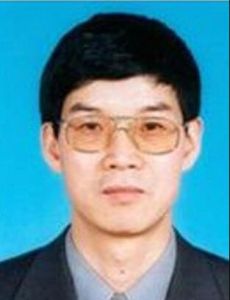
主要研究領域:
資源環境、數學模型與地理信息系統主要研究興趣:
生態系統綜合評價模型、發展預測模型、多源信息融合模型、可持續發展集成模型、模型庫開發及其與GIS集成。主要研究經歷:
1986年9月至1989年7月,在蘭州大學地理系攻讀自然資源利用專業碩士學位, 論文題目為《甘肅省河西地區土地承載能力多目標決策模型》。 1989年9月至1992年7月,在中國科學院生態環境研究中心攻讀生態學專業博士學位,論文題目為《土地管理的系統模型及其套用》。 1992年9月至1995年3月,在國家科委從事區域發展方面的研究和協調工作,參加了亞歐大陸橋、圖們江跨國經濟區、瀾滄江-湄公河跨國經濟區和西線南水北調超前期研究等研究項目的有關研究 活動。1995年4月至1998年5月,在聯邦德國環境研究中心套用景觀生態學部和區域未來模型研究小組,從事土地戰略管理模型研究。應邀到德國慕尼黑技術大學的景觀生態研究所、 德國農業景觀和土地利用研究中心的景觀生態模型研究所、奧地利國際套用系統分析研究所、斯洛伐克科學院的景觀生態研究所等單位進行合作研究和學術交流。 自1998年7月以來,在中國科學院地理科學與資源研究所資源與環境信息系統國家重點實驗室從事資源環境模型與系統模擬研究。主要原創性研究成果包括高精度曲面建模方法、變化探測模型、生態閾值模型、多尺度多樣性模型和連通性模型等。 已完成中國HLZ生態系統空間格局自1960年以來的變化趨勢和未來90年情景的模擬與分析,已完成中國人口空間分布自1930年以來變化趨勢和未來20年情景的模擬分析, 已完成中國生態系統食物供應能力及其未來90年情景的模擬與分析。在國內外學術刊物上發表學術論文80餘篇,出版專著2部。
近5年代表性學術著作::
1. 岳天祥, 杜正平. 2005. 高精度曲面建模: 新一代GIS與CAD的核心模組. 自然科學進展,15(3):73-82.2. Tian Xiang Yue, Ying An Wang, Ji Yuan Liu, Shu Peng Chen, Dong Sheng Qiu, Xiang Zheng Deng, Ming Liang Liu, Yong Zhong Tian, Bian Ping Su. 2005. Surface Modelling of Human Population Distribution in China. Ecological Modelling,181(4): 461-478.
3. Tian Xiang Yue, Ying An Wang, Ji Yuan Liu, Shu Peng Chen, Yong Zhong Tian, Bian Ping Su. 2005. MSPD scenarios of spatial distribution of human population in China. Population and Environment 26(3): 207-228.
4. Tian XiangYue, Ji Yuan Liu, Si Qing Chen, Zheng Qing Li, Sheng Nan Ma, Yong Zhong Tian, Feng Ge. 2005. Considerable effects of diversity indices and spatial scales on conclusions relating to ecological diversity. Ecological Modelling (in press).
5.Tian Xiang Yue, Ze Meng Fan, Ji Yuan Liu. 2005. Changes of major terrestrial ecosystems in China Since 1960. Global and Planetary Change (in press).
6. Tian Xiang Yue, Zhen Ping Du, Ji Yuan Liu, Shu Peng Chen, Ze Meng Fan, Ying An Wang, Wei Huan Chen, Huai Dong Qiu. 2005. High Precision Surface Modelling: Progress (I). ISPRS Journal of Photogrammetry & Remote Sensing (in press).
7. 岳天祥, 杜正平, 劉紀遠,2004,高精度曲面建模與誤差分析,自然科學進展,14(2):83-89.
8. Tianxiang Yue, Bing Xu, Jiyuan Liu. 2004. A patch connectivity index and its change on a newly born wetland at the Yellow River Delta. International Journal of Remote Sensing, 25(21): 4617 – 4628.
9. 岳天祥.2003. 資源環境數學模型手冊, 北京:科學出版社.
10. 岳天祥,劉紀遠. 2003. 生態地理建模中的多尺度問題,第四紀研究,23(3):256-261.
11. Tian Xiang Yue, Ying An Wang, Shu Peng Chen, Ji Yuan Liu, Dong Sheng Qiu, Xiang Zheng Deng, Ming Liang Liu, Yong Zhong Tian. 2003. Numerical Simulation of Population Distribution in China. Population and Environment 25 (2), 141-163.
12. Tian Xiang Yue, Ji Yuan Liu, Sven Erik Jørgensen, Qinhua Ye. 2003. Landscape change detection of the newly created wetland in Yellow River Delta. Ecological Modelling: An International Journal on Ecological Modelling and Systems Ecology, 164: 21-31.
13. Tianxiang Yue, Shupeng Chen, Bing Xu, Qingsheng Liu, Huiguo Li, Gaohuan Liu, Qinghua Ye. 2002. A curve-theorem based approach for change detection and its application to Yellow River delta. International Journal of Remote Sensing, 23 (11): 2283-2292.
14. 岳天祥,劉紀遠,2001,多源信息融合數字模型,世界科技研究與發展,23(5):19-25.
15. 岳天祥,劉紀遠,2001,第四代地理信息系統研究中的尺度轉換數字模型,中國圖像圖形學報,6(9):907-911.
16. 岳天祥,2001,城市環境容量集成模型研究,地球信息科學,3(5):49-52.
17.Tianxiang Yue, Jiyuan Liu, Sven Erik Jørgensen, Zhiqiang Gao, Shihuang Zhang, Xiangzheng Deng. 2001. Changes of Holdridge life zone diversity in all of China over a half century. Ecological Modelling: An International Journal on Ecological Modelling and Systems Ecology, 144: 153-162.
18. Y Tianxiang Yue. 2000. Stability analysis on the sustainable growth range of population. Progress in Natural Science, 10(8):631-636.

