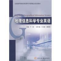
內容簡介
本書以培養學生地理信息科學專業英語文獻閱讀和翻譯能力為主要目的,以地理信息系統、遙感、全球定位系統和3s集成理論與技術為主要內容,分為4個部分18章內容。第一部分為地理信息系統的基本原理、技術方法及套用,第二部分為遙感基本原理、技術方法及套用,第三部分為全球定位系統的基本原理、技術方法及套用,第四部分為3S集成理論、關鍵技術及套用。書中每章後均附有專業辭彙和難點句子的翻譯。
本書可以作為地理信息系統、遙感和全球定位系統等專業的本科生和研究生的教材,也可供相關專業的技術人員和教師參考使用。
目錄
Part 1 Geographical Information Systems
Chapter 1 Overview of Geographical Information Systems
Chapter 2 Principles of Geographical Information Systems
Chapter 3 Geo-referencing
Chapter 4 Geospatial Data
Chapter 5 Spatial Analysis
Chapter 6 Applications of GIS
Part 2 Remote Sensing
Chapter 7 Fundamentals of Remote Sensing
Chapter 8 Remote Sensing Imaging Principles
Chapter 9 Remote Sensing Digital Images Processing
Chapter 10 Remote Sensing Image Interpretation
Chapter 11 Remote Sensing Applications
Part 3 Global Positioning System
Chapter 12 Introduction to Global Positioning System
Chapter 13 Datums, Coordinate Systems and Time Systems
Chapter 14 GPS Signal Structure and Basic Measuring Ways
Chapter 15 GPS Errors and Biases
Chapter 16 GPS Positioning Modes
Chapter 17 GPS Applications
Part 4 3S Integration
Chapter 18 The Basic Principles of 3S Integration
References

